
Destination Sardinia
  • The island
    • History
    • Regions
    • Points of interest
    • Climate
    • Geography
    • Nature
    • Beaches
    • Festivals
    • Language
  • Travel time
  • Arrival
    • Car/Motorbike
    • Ferry
    • Plane
    • Train
  • Accommodation
    • Hotel
    • Bed and Breakfast
    • Holiday flat
    • Holiday house
    • Agriturismo
    • Camping
    • Campervan
  • Food and Drinks
    • Eating out
    • Self-catering
    • Culinary specialities
  • Mobility
    • Car
    • Motorbike
    • Bike
    • Bus
    • Railway
    • Ship and boat
  • Points of interest
  • Activities
    • Hiking
    • – Tour tips
    • Climbing
    • Surfing
    • Diving and snorkelling
    • Fishing
    • Riding
  • Pract. tips
    • Literature
    • Maps
    • Language
    • Post and telephone
    • Internet
    • Opening hours
    • Photography
    • Children
    • Health
    • Dogs and pets
    • Souvenirs
    • Weblinks
  • Menu Menu
  • The island
    • The island
    • History
    • Regions
      • Anglona/Turritano
      • Arborea
      • Barbagia
      • Baronia
      • Cagliari region
      • Campidano
      • Gallura
      • Iglesiente/Sulcis
      • Logudoro/Meilogu
      • Nurra
      • Ogliastra
      • Planargia
      • Quirra/Sarrabus
      • Sarcidano/Marmilla
    • Points of interest
      • Alghero
      • Alghero, north
      • Archipelago di La Maddalena
      • Ardara / Sant‘ Antioco di Bisarcio
      • Argentiera / Grotta di Nettuno
      • Aritzo
      • Arzachena and surroundings
      • Bosa
      • Burgos and surroundings
      • Cagliari
      • Capo Comino / Spiaggia di Berchida
      • Carbonia and Monte Sirai
      • Castelsardo and surroundings
      • Churches near Sassari
      • Costa del Sud
      • Costa Rei and hinterland
      • Costa Smeralda, Palau and surroundings
      • Costa Verde
      • Fonni and surroundings
      • Fordongianus
      • Giara di Gesturi
      • Gola su Gorroppu / Codula di Luna
      • Gulf of Orosei
      • Iglesias and Grotta di San Giovanni
      • Ingurtosu
      • Isola di Sant’Antioco
      • Is Pirois, Funtana Coberta, Pranu Muteddu
      • Ittireddu
      • Macomer and surroundings
      • Montiferru-Area
      • Nebida, Masua and Buggerru
      • Nora
      • Nuoro and surroundings
      • Nuraghe Arrubiu
      • Nuraghe Iloi and surroundings
      • Nuraghe Losa
      • Nuraghe Santu Antine / Sant‘ Andria Priu
      • Nuraghe Su Nuraxi
      • Olbia and surroundings
      • Orgosolo
      • Oristano / Sinis-Peninsula / Tharros
      • Orosei and Biderosa Nature Park
      • Orosei’s hinterland
      • Osini and Ulassai
      • Ozieri
      • Porto Torres and Monte d’Accoddi
      • Posada and Surroundings
      • Sadali
      • Santa Cristina
      • Santa Teresa / Capo Testa
      • Santa Vittoria
      • Sassari and Noeddale Necropolis
      • Sedini and Martis
      • Siniscola and Surroundings
      • Stintino and Isola Asinara
      • Su Golgo, Sa Pedra Longa, Santa Maria Navarrese
      • Su Romanzesu and Nuraghe Loelle
      • Su Tempiesu and Nuraghe Noddule
      • Tempio di Antas
      • Tempio Pausania and Surroundings
      • Tonara, Sorgono, San Mauro, Menhire Biru ‚e Concas
      • Trenino Verde (Arbatax-Sadali)
    • Climate
    • Geography
    • Nature
    • Beaches
    • Festivals
    • Language
  • Travel time
  • Arrival
    • Arrival
    • Car/Motorbike
    • Ferry
    • Plane
    • Train
  • Accommodation
    • Accommodation
    • Hotel
    • Campervan
    • Agriturismo
    • Bed and Breakfast
    • Camping
    • Holiday house
    • Holiday flat
  • Food and Drinks
    • Food and Drinks
    • Eating out
    • Self-catering
    • Culinary specialities
  • Mobility
    • Mobility
    • Car
    • Motorbike
    • Bike
    • Bus
    • Railway
    • Ship and boat
  • Points of interest
    • Alghero
    • Alghero, north
    • Archipelago di La Maddalena
    • Ardara / Sant‘ Antioco di Bisarcio
    • Argentiera / Grotta di Nettuno
    • Aritzo
    • Arzachena and surroundings
    • Bosa
    • Burgos and surroundings
    • Cagliari
    • Capo Comino / Spiaggia di Berchida
    • Carbonia and Monte Sirai
    • Castelsardo and surroundings
    • Churches near Sassari
    • Costa del Sud
    • Costa Rei and hinterland
    • Costa Smeralda, Palau and surroundings
    • Costa Verde
    • Fonni and surroundings
    • Fordongianus
    • Giara di Gesturi
    • Gola su Gorroppu / Codula di Luna
    • Gulf of Orosei
    • Iglesias and Grotta di San Giovanni
    • Ingurtosu
    • Isola di Sant’Antioco
    • Is Pirois, Funtana Coberta, Pranu Muteddu
    • Ittireddu
    • Macomer and surroundings
    • Montiferru-Area
    • Nebida, Masua and Buggerru
    • Nora
    • Nuoro and surroundings
    • Nuraghe Arrubiu
    • Nuraghe Iloi and surroundings
    • Nuraghe Losa
    • Nuraghe Santu Antine / Sant‘ Andria Priu
    • Nuraghe Su Nuraxi
    • Olbia and surroundings
    • Orgosolo
    • Oristano / Sinis-Peninsula / Tharros
    • Orosei and Biderosa Nature Park
    • Orosei’s hinterland
    • Osini and Ulassai
    • Ozieri
    • Porto Torres and Monte d’Accoddi
    • Posada and Surroundings
    • Sadali
    • Santa Cristina
    • Santa Teresa / Capo Testa
    • Santa Vittoria
    • Sassari and Noeddale Necropolis
    • Sedini and Martis
    • Siniscola and Surroundings
    • Stintino and Isola Asinara
    • Su Golgo, Sa Pedra Longa, Santa Maria Navarrese
    • Su Romanzesu and Nuraghe Loelle
    • Su Tempiesu and Nuraghe Noddule
    • Tempio di Antas
    • Tempio Pausania and Surroundings
    • Tonara, Sorgono, San Mauro, Menhire Biru ‚e Concas
    • Trenino Verde (Arbatax-Sadali)
  • Activities
    • Activities
    • Hiking
    • – Tour tips
    • Climbing
    • Surfing
    • Diving and snorkelling
    • Fishing
    • Riding
  • practical tips
    • practical tips
    • Literature
    • Maps
    • Language
    • Post and telephone
    • Internet
    • Opening hours
    • Photography
    • Children
    • Health
    • Dogs and pets
    • Souvenirs
    • Weblinks
  • Search…
You are here: Home1 / practical tips2 / Maps

deutsch

Maps

Maps of Sardinia

Good maps are important

An overview map of the sights in Sardinia can be found here.

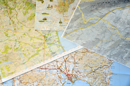
Good maps are essential for getting to know the island.
Even a navigation system cannot replace a map when planning a holiday, because these devices primarily refer to the road network, whereas good maps also show the terrain and places of interest.
In recent years, so much has been invested in road construction in Sardinia that the publishers of road maps can hardly keep up with updating.

In my opinion, the best road map of Sardinia by far is “Sardegna” from TCI (Touring Club Italiano) sheet 15, from the series “Grandi carte d’Italia” at a scale of 1:200000.
It is regularly updated, also includes small side roads and shows the towns not only as a point, but also in their dimension.
The most scenic routes are highlighted in green, sights such as nuraghe and lonely churches are precisely marked.
When planning your route, you should look carefully because unpaved roads are also marked here, and their markings are not always immediately obvious.

If you travel to Sardinia more often, keep the old maps. I have made the experience that in updated new editions not all side roads of the old edition are always marked – although they still exist of course.

Similar maps are:

MARCO POLO Map Sardinia 1:200 000 or.
Sardinien Nr. 16 Regionalkarte Italien 1:200 000 (Kümmerly+Frey)

There are only a few detailed hiking maps of Sardinia. For occasional tours, the maps included in the hiking guides are good.
Meanwhile, Kompass-Verlag offers very nice hiking map sets of Sardinia. These sets are divided into three regions (north, centre, south) and contain 4 maps each.
Some tourist offices also offer free hiking maps of the surrounding area. Interesting sights are often marked on these sheets.

For hikes without a guide in Sardinia, a good sense of orientation and the confident use of a map and compass or GPS is necessary anyway.
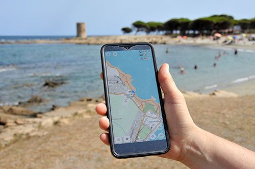
OpenSteetMap app

OpenSteetMap app

For GPS devices there are free downloads of maps from OpenStreetMap.
Since these maps are available under an open licence, there are now various providers who create their own special maps from the data.
I prefer to use the maps from the website Freizeitkarte on my Garmin.

There are also various apps from OpenStreetMap for your smartphone.
While Google Maps mainly refers to the road network, most hiking trails and many details are also marked here.
The biggest advantage, however, is that you can save the maps and they will then also work offline.
Especially in remote areas without a mobile network, this is of course very convenient.

City maps of the larger cities are available free of charge at the local tourist offices.

Tip: If you use a navigation system in your car, never enter the “shortest route” in the route options. Depending on the device, you may be guided along unpaved secondary roads (strade biance), which are a real challenge for normal cars or motorhomes. So you would not save any time.
In addition, although there are no speed limits on many stretches of road in the mountains, it is seldom possible to drive more than 50 km/h. The navigation system now calculates the route at 90 km/h and guides you along the winding side roads.
This is particularly annoying on longer journeys. After a comparison with the map, you can then choose an optimal route by entering intermediate destinations.

Search Search

Instagram

Follow us

Legal Notice

Legal Notice

Privacy Policy

Privacy Policy

Contact

Contact

© Copyright Traumziel-Sardinien 2009-2026
Scroll to top Scroll to top Scroll to top